Mountain vs. Desert Hiking
A Comparative Guide for exploring Southern Nevada
Las Vegas, Nevada is a gateway to some of the most diverse hiking opportunities in the United States!
Whether you prefer the cool, forested mountains or the fierce desert landscape, a short drive takes you from the bright lights of Las Vegas to the serenity of the Mojave and Spring Mountains region.
It’s critical to understand the differences between mountain and desert hiking before setting out on your adventure. Here, we explore the key factors and differences in
- Climate
- Terrain
- Elevation
- Difficulty
- Essential Gear
Notable hikes are provided as examples that highlight the best of our nearby mountain and desert trail hiking routes.
Climate - Alpine Breezes or Desert Heat
Climate is one of the most significant differences between mountain and desert hiking near Las Vegas, NV.
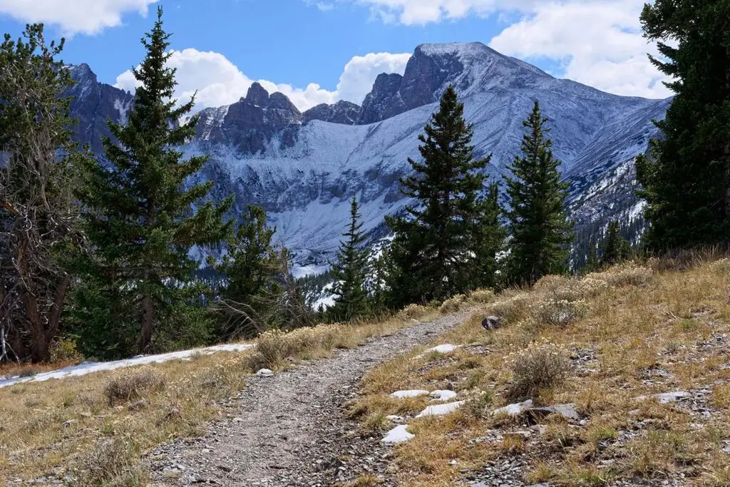
Hiking in the Spring Mountains and Mount Charleston areas:
- Cooler temperatures
- Higher elevations.
- Summer daytime temps range from 70s-80s (°F)
- Summer night temps may drop to the 40s (°F)
- High season: May-October
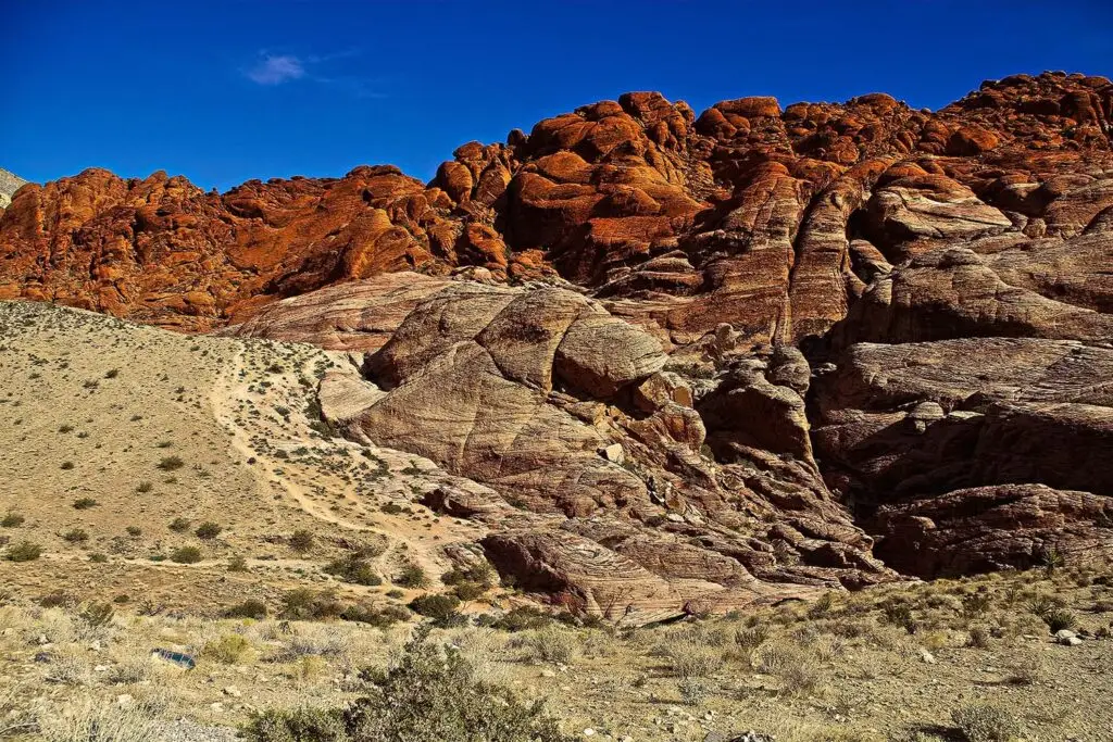
Desert hiking in Red Rock Canyon and Valley of Fire State Park areas:
- Extreme heat
- Arid climate and low humidity
- Abundant sunshine with minimal shade
- Rapid dehydration risk
- Summer daytime temps range from 100-120 (°F)
- Summer night temps are often in the 80s-90s (°F)
- High Season: October-April
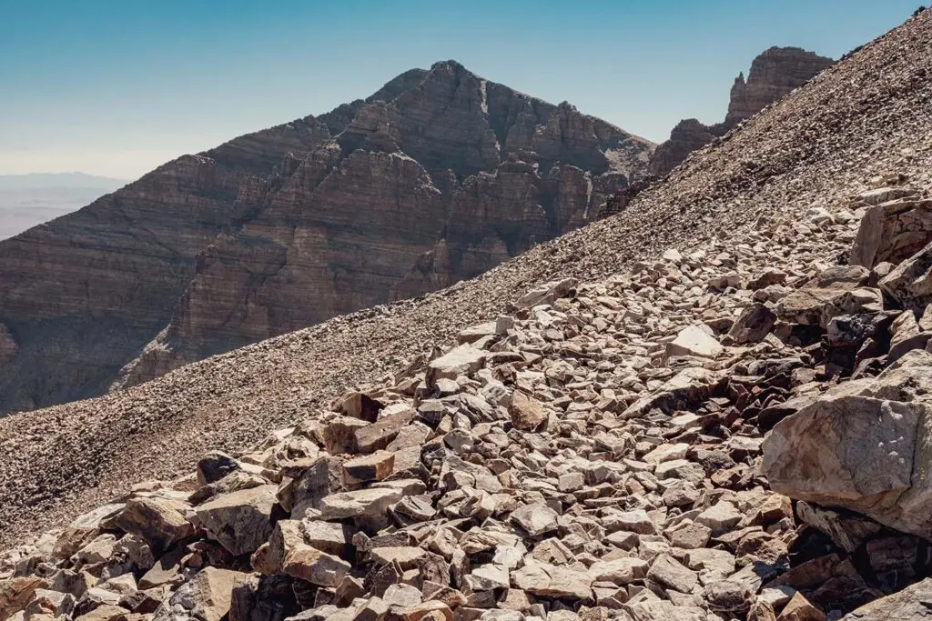
Terrain - Rugged Peaks vs. Open Vistas
Mountain hikes often take place above 5,000 ft. Most desert hikes are below 4,500 ft.
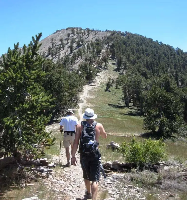
Characteristics of mountain terrain near Las Vegas:
- Steep ascents
- Rocky trails
- Pine forests
- Loose scree or snow at higher elevations
The landscape can be demanding and requires careful footing and navigation around natural obstacles like boulders and fallen trees.
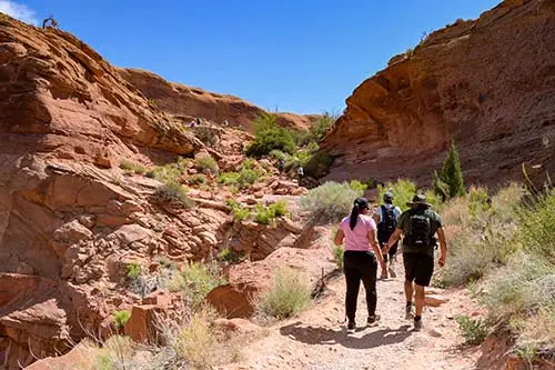
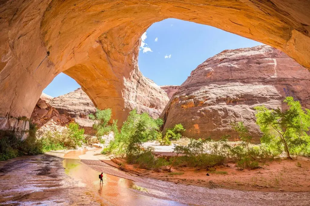
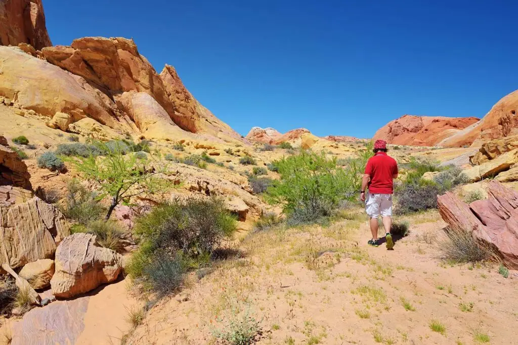
Characteristics of desert terrain in the Mojave:
- Ancient red rock formations
- Sweeping vistas
- Sand and gravel washes
- Fierce, untamed beauty of desert vegetation
- Minor scrambling over sandstone ledge
The wide-open desert terrain increases sun exposure, making shade a precious commodity.
Elevation - High or Low - Trail Examples
To give you an idea of what we’re talking about for elevation:
- The Las Vegas Strip is approximately 2,000 ft above sea level.
- The scenic Red Rock Loop, in the Red Rock National Conservation Area ranges from 3,394 ft to 4,771 ft.
- The Mt. Charleston region hikes range from 7,000 ft to 11,900 ft (Mt. Charleston Peak).
Mountain Hikes
Mountain hikes around Las Vegas can vary significantly in length and elevation. According to AllTrails, there are nearly a100 trails in the Spring Mountains National Recreation Area alone.
Characteristics of mountain trails in Southern Nevada:
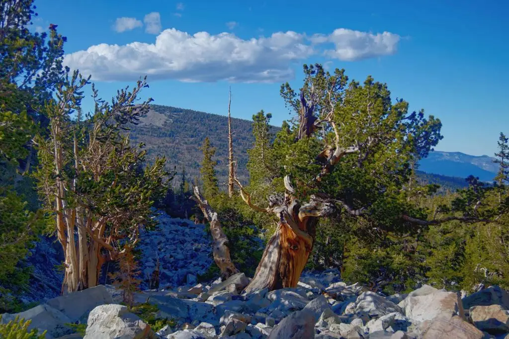
- Forests with Ponderosa and Bristlecone pines
- Rocky, loose terrain
- Steep Ascents
- Varying difficulty
- Snow and ice during the winter in higher elevations
Go Mt. Charleston cites several trails near and along the North and South loops.
Examples of Short Mountain Hiking trails (3 miles or less):
- Eagle’s Nest Trail– Rated Easy – 1.9 miles
- Robbers Roost – Rated Moderate – .7 miles
- Pack Rat Route – Rated More Difficult – .4 miles
Examples of Mid-length Mountain Hiking Trails (3 to 7 miles):
- Acastus Trail – Rated Easy – 3.3 miles
- Lower Bristlecone Trail – Rated Moderate – 5.9 miles
- Raintree – Rated More Difficult – 5.5 miles
Examples of Longer Day Hike Mountain Hiking Trails (8 miles or longer):
These trails are not just long – they rise in elevation where the air is thinner, which makes the trek more strenuous. Mountain routes this high are often snow covered from October to April. They are typically not appropriate for the first time or beginner hiker.
- Catch Pan – Rated More Difficult – 10.8 miles
- Bonanza Trail – Rated Most Difficult – 18.1 miles
- Charleston Peak – Rated Most Difficult – 16-20 miles depending on the route
Cell service is unavailable/unreliable in many areas around Mt. Charleston. Research and prepare for the routes you want to explore either on your own or with VegasHikers to help ensure a safe and enjoyable day.
Desert Hikes
Desert hikes near Las Vegas generally start and finish at lower elevations (2,500-4,500 ft). The dry desert air whisks away any moisture from your body, so remember to take small sips often.
Examples of Short Desert Hiking trails (3 miles or less):
- Willow Spring Picnic Area & Petroglyph Wall – Rated Easy – 1.1 miles
- Calico Tanks – Rated Moderate – 2.2 miles
- Ice Box Canyon – Rated More Difficult – 2.2 miles
Examples of Mid-length Desert Hiking Trails (3 to 6 miles):
- Middle Oak Creek – Rated Easy – 3 miles
- Dale’s Trail – Rated Moderate – 4 miles
- White Rock Loop – Rated Difficult – 6.2 miles
Examples of Longer Day Hike Desert Hiking Trails (6 miles or longer):
- Grand Circle Loop – Rated More Difficult – 11.4 miles
- North Peak – Rated More Difficult – 11.8 miles
- Hidden Arches Trail – Rated More Difficult – 6.7 miles
Cell service is unavailable/unreliable in many areas around Mt. Charleston. Research and prepare for the routes you want to explore either on your own or with VegasHikers to help ensure a safe and enjoyable day.
Difficulty- Factors That Shape the Challenge
Both mountain and desert hikes present unique challenges, but the factors influencing difficulty differ.
Mountain Hikes
- Physically demanding due to steep grades and altitude.
- Subject to variable weather conditions, such as sudden thunderstorms or snow.
- Require fitness, stamina, and experience with changing conditions.
Desert Hikes
- Coping with the heat, dehydration, and lack of shade is challenging.
- Even relatively flat trails can become difficult if not properly prepared for sun exposure and water loss.
- Navigation can also be trickier, where well-marked trails are less common.
Essential Gear - Prepare for the Environment
Proper gear is crucial for both types of hikes, but the requirements differ based on climate and terrain.
Mountain Hiking Essentials:
- Sturdy boots with good ankle support
- Layered clothing for temperature changes
- Rain protection
- Trekking poles
- Extra food and water (up to a gallon per person for long hikes)
- Sun protection is still important, but less critical than on desert hikes
- First aid kit and emergency whistle
- Electrolyte supplements
- Navigation tools (like a map and compass or GPS)
Desert Hiking:
- Plenty of water – at least 2 liters for short hikes
- Lightweight, breathable clothing
- Wide-brimmed hat
- Sunglasses
- Ample sunscreen
- First aid kit and emergency whistle
- Electrolyte supplements
- Navigation tools (like a map and compass or GPS)
- Lots of water – Yes, it’s listed twice, it’s that important!
Water is critical for safe desert hiking. During warmer months, even a two-hour hike can require 2 liters of water and at least 1 gallon per person for longer hikes.
Always check weather conditions! Bring appropriate gear and respect the environment to ensure a safe adventure. From alpine summits and fiery sandstone waves to glorious sunrises and sunsets, Las Vegas is a hiker’s paradise!
Hiking with VegasHikers
Both Mount Charleston and Red Rock Canyon National Conservation Area (RRCNCA) have visitor centers. Knowledgeable staff can help you find the perfect route.
At VegasHikers, we have passionate organizers and enthusiastic members that spend a significant amount of time both in the desert and mountains. Browse our events then sign up for one that sounds like fun. If you’re not already a member, join today, get outdoors, and explore with us!